
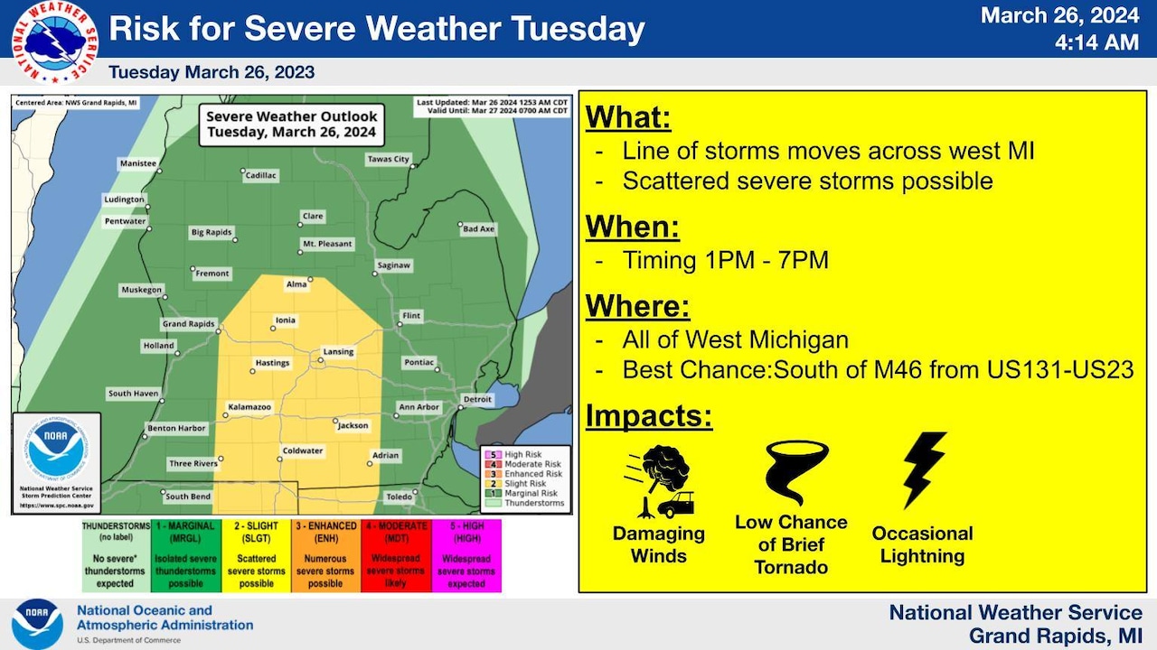
Severe weather chances have increased today for a portion of central and southern Michigan. Forecast details from the National Weather Service show the biggest threats with this possible severe weather will come this afternoon and early evening. They include damaging wind gusts up to 60 mph, lightning strikes, power outages and the chance for a weak, isolated tornado.
Severe weather chances have increased from marginal to slight in the area shown in yellow on the map. This includes Grand Rapids, Kalamazoo, Lansing and Jackson. The higher risk area goes as far north as Alma, and stretches down to Coldwater.
The west side of this area has the highest risk for severe weather from 1 to 7 p.m. today, while the southeast side of the state will see its biggest window for this weather from 4 to 11 p.m. as the storm system tracks east and leaves Michigan.
“Scattered thunderstorms are expected to move across lower Michigan this afternoon,” National Weather Service meteorologists in Grand Rapids said. “Some storms may be severe. Damaging winds and lightning are the main hazards, though a brief tornado cannot be ruled out. The highest risk is south of M-46 between U.S. 131 and U.S. 23. Stay weather aware today.”
After the storm system moves out tonight, cooler weather will rush in and stick around for a couple days.


