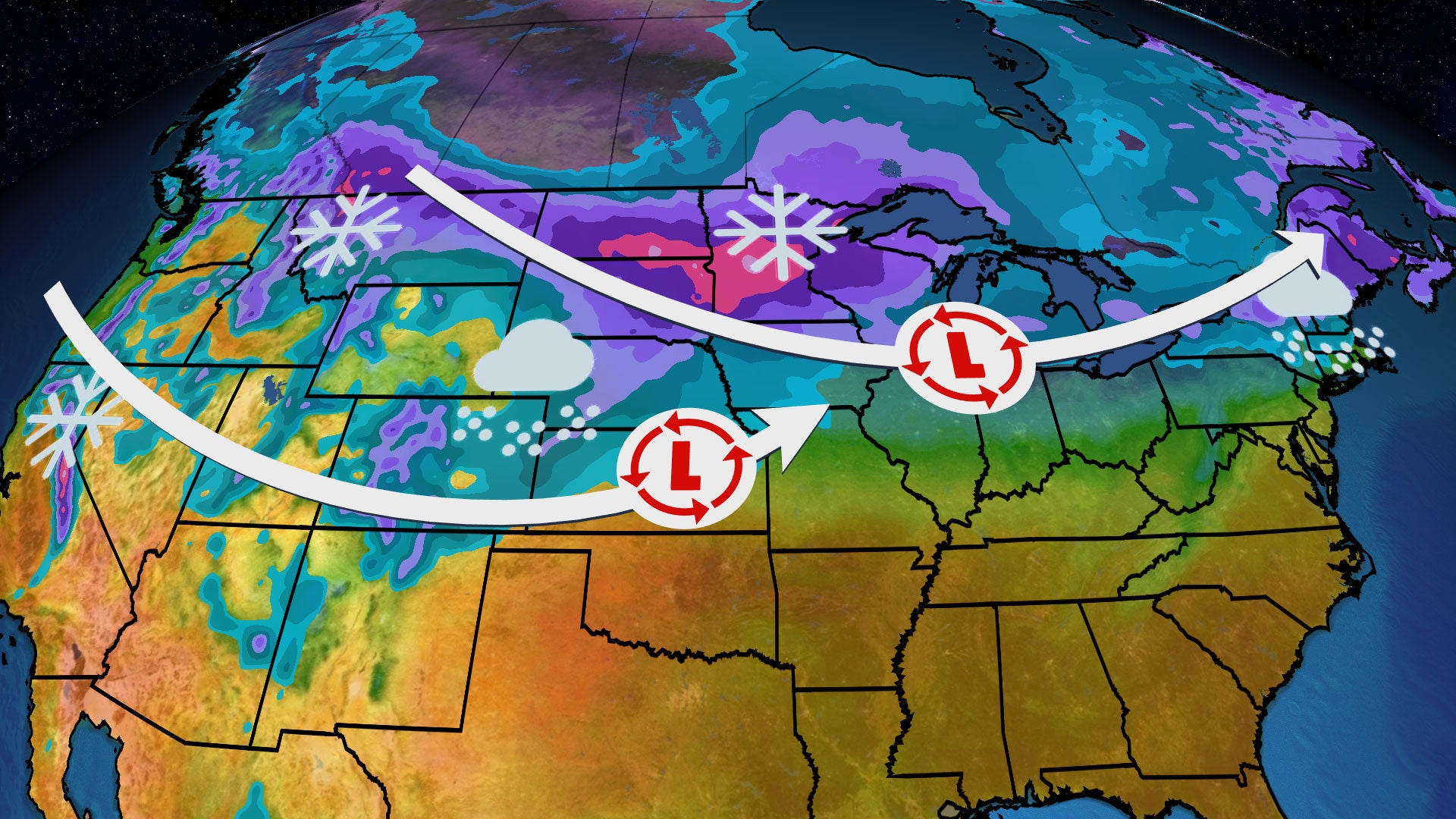

- One area of low pressure will spread light to moderate snow from the Northern Plains into the interior Northeast late this week.
- A stronger area of low pressure will track through the central U.S. late this weekend into early next week.
- Locally heavy snow and gusty winds are expected to accompany this second system.
It may be spring but the weather will feel more like winter with two rounds of snow moving through the northern tier. Here’s what we know about the two snowy systems:
Round 1 Timing
Snow will increase across the Northern Plains into Thursday.
An area of low pressure will track eastward into the Midwest Thursday night and Friday, bringing the chance of snow to the upper Midwest and Great Lakes regions. Be prepared for slippery travel – Friday morning’s commute could be impacted in places like Madison, Wisconsin, and Milwaukee.
This system will then move through the Northeast Friday night and Saturday; snow is expected to fall in parts of the interior Northeast and northern New England.

Thursday Night’s Forecast
Round 1 Snowfall Totals
Most areas from Montana through the Great Lakes will see a few inches of snow.
However, there will be pockets of heavier snowfall, including in parts of southern Wisconsin, lower Michigan, upstate New York and northern New England.
(15-min details: For even more granular weather data tracking in your area, view your 15-minute details forecast in our Premium Pro experience.)

Snowfall Forecast
(Locally higher amounts are possible.)
Round 2 Is Close Behind
The second area of low pressure will move into the West this weekend, spreading snow through the higher elevations.
Late Sunday or early Monday, it will push into the Plains and develop into a strong low-pressure system.
Snow is possible as early as Saturday night in the Northern Plains and upper Midwest. The Northern and Central Plains, as well as parts of the upper Midwest, can expect snow Sunday into Monday.
Strong wind gusts are also anticipated and will make travel dangerous when combined with heavy snowfall.

How Much Snow With Round 2?
Moderate to heavy snow is expected in parts of the Cascades, Sierra and Rockies this weekend.
It is too early for specific snowfall totals in the Plains and Midwest, but very heavy snowfall is likely in some areas. Snowfall totals of over a foot are possible.
The upcoming rounds of snow may help to make a dent in some of the deficits that have developed this season. Minneapolis, for example, has received just over 14 inches of snow this season, which is more than 30 inches below average. The upcoming snow there may be close to what it has picked up for the whole season.
(192-hours: Further beef up your forecast with our detailed, hour-by-hour breakdown for the next 8 days – only available on our Premium Pro experience.)

Snowfall Outlook
(While it is too far out in time to specify exact forecast snowfall totals, areas in the purple and pink contours have the highest chance at heavy snowfall.)
Linda Lam is a lead meteorologist at weather.com. Growing up in Massachusetts, she developed a fascination for winter storms and hurricanes that led her to pursue a career in meteorology.
